Enter your ZIP to see whether this is legal to plant in your state, and whether it survives your winter.
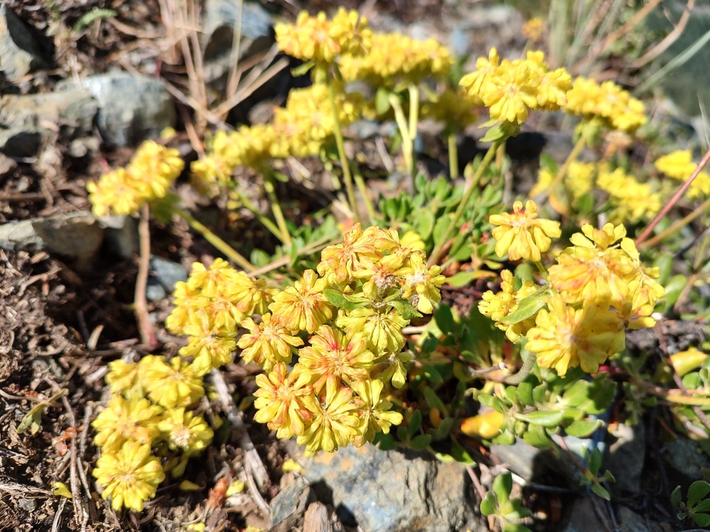
Sulphur-flower buckwheat is generally rated fire resistant, although a 7-of-10 field score makes that judgment qualified.
Five recommendations support using this low-water groundcover in fire-resistant landscaping. Northwestern university extension services list Eriogonum umbellatum as fire resistant, while Oregon State profiles it among suitable groundcovers. FireSmart BC approves it but also flags it for more research. Fremont County Firewise lists it as a groundcover, and NFPA Firewise Communities recommends it for landscaping in the Black Hills.
The main caution comes from Idaho Firewise. Its field-trial database gives sulphur-flower buckwheat a fire-resistance score of 7 of 10. That 7 falls short of the 8-to-10 recommendation band in CSU’s published thresholds for the scale, landing in the mixed band of 4 to 7. That does not overturn the other recommendations, but it prevents an unqualified claim based on measured performance.
The practical conclusion is that sulphur-flower buckwheat is a defensible fire-resistant choice, especially across the western regions covered by these sources, but the primary evidence is limited and not uniformly strong. FireSmart BC’s research flag and Idaho’s mixed-band score are good reasons to treat “fire resistant” as a relative rating, not a promise that the plant will not burn.
Form
groundcover
Mature height
~1 ft
Water need
low
Rated in
Black Hills, South Dakota; British Columbia; Fremont County, Wyoming; OR/WA/ID +2
On this lot
1. Fire evidence and conditions
Fire evidence
Fire-resistant — location does not change the cited classification.
Black Hills, South Dakota; British Columbia; Fremont County, Wyoming; OR/WA/ID; Pacific Northwest (Oregon / Washington / Idaho); southern Idaho / Intermountain
Maintenance
Typed publication scope: 4 scopes across 4 cited fire sources
Black Hills (SD footprint); partial normalized coverage
The page explicitly limits itself to the Black Hills, and NFPA Firewise's archived 2006 plant-list index files it under South Dakota. FireApproved publishes 47 exact genus or species owners from 48 printed rows. This is bounded Black Hills context, not statewide South Dakota coverage or a finding that a plant suits a particular site.
Fremont County (WY footprint); partial normalized coverage · 2011-02-25
The source identifies itself as the Fremont County Firewise Plant List. FireApproved publishes its 92 exact source owners as Fremont County regional context. No methodology, current county endorsement, statewide Wyoming scope, or site-specific suitability is inferred.
Southern Idaho (ID footprint); partial normalized coverage · 2013-11-08
The official database labels itself "For Southern Idaho" and describes Idaho residents at the urban-rangeland interface. FireApproved publishes 419 existing plant owners that cite its scored rows. This bounded Southern Idaho scope is regional context, not statewide coverage or a conclusion that the score transfers unchanged to every Idaho site.
The October 2023 joint Pacific Northwest Extension publication explicitly names Oregon, Washington, and Idaho and publishes more than 150 plant profiles. FireApproved has normalized 155 exact plant records from the source; publication scope does not assert that every listed plant suits every site within the three states.
2. Why this plant is relevant here
State distribution
Documented in AZ, CA, CO, ID, MT, NV, OR, UT, WA, WY.
Native range
Current cited native range in AZ, CA, CO, ID, MT, NM, NV, OR, UT, WA, WY.
Introduced / established
USDA hardiness
Documented minimum 5b; no upper limit is documented.
3. Legal, ecological, and broader status
Legal-list status
Seed-list status
Reported invasive here
Broader regional context
Federal context
How to read this page
The status above is computed from the cited rows below: independent recommendations can support a fire-resistant result, an avoid row can produce keep-away, and disagreement stays visible as conflict. Placement notes preserve each source’s own scheme rather than translating unlike rules into one scale. This is evidence about a plant, not permission to plant it in every part of the defensible space; Zone 0 remains noncombustible.
Native and introduced range evidence
These are exact U.S. botanical-area records from the cited range source. Native and
introduced describe biogeographic relationship, not fire performance or planting approval.
Doubtful and extinct rows stay visible but do not count as current presence.
The lossless worldwide derivative is retained once in the research corpus; object pages repeat only exact U.S. areas needed by the local lens. The JSON twin carries the same page assertions.
Plant hardiness evidence
These values describe the plant source. Your ZIP zone comes from the separate 2023 USDA
Plant Hardiness Zone Map. Whole-zone values stay whole-zone, and a single unresolved value
is not treated as a tolerance range. Different source boundaries stay separate: overlapping
statements are compared independently, while only ranges with no shared zone are called a conflict.
Source location: PlantCharacteristics record 60991, Temperature, Minimum (°F).
Where its sources say to plant it
Placement rules below use each source's own distances or named zones, tied to its rating.
They are not interchangeable with the directory's current Zone 0 guidance.
Fire Resistance of Plants Master Database: plantable at 40' from home [Idaho minimum planting distance] (mid-scale rating)
Firewise Plant Material for the Black Hills: Flowers & groundcovers [black-hills-plant-form-table] (with its recommendation)
The evidence
Grouped by what each source concluded. Primary evidence rated the plant itself
(a lab, field program, or original curation); corroboration compiled or
republished another source's rating and resolves to its root lineage.
“Fremont County Firewise Plant List — Eriogonum umbellatum — Sulfur Flower”
Listed in the source's Ground Covers section; the page describes its listed Firewise plants as generally low-growing, low-debris, and relatively moist.
The introduction describes all table entries as fire-resistive plants that can be used in landscaping. Printed-name correction used for exact matching: Erriogonum umbellatum -> Eriogonum umbellatum.